
The main concern is IF we get some mixed precipitation along with the rain tonight. If you're planning on being out for New Years Eve, that could cause some travel problems, so be cautious. Rain could change over to snow by early morning, but even then, for most of us, we're not expected any accumulation to speak of, except in Southern Illinois, and even then, minimal amounts. Happy New Year! Be Safe!


RADAR:
SATELLITE:
FORECASTS:
Paducah Union City
Carbondale Cape
Severe WX Outlook
Model Charts Models
PSU Wall Graphical
MEM Graphical
PAH Hazardous
SPC Meso 12-48 HR
3-7 Day HRRR Radar
WRF-NMM Radar 15 Day Forecast
GFS NAM MURF
SREF EURO
Forecast Model Animations
PAH Forecast Discussion
WINTER FORECASTS
HPC Winter Weather Forecasts
Wintercast Computer Snowfall Output
Snowstorm Tracks and Probabilities
HPC Day 1 Snow
HPC Day 2 Snow
HPC Day 3 Snow
-->
Severe WX Outlook:
 TODAY-TONIGHT
 TOMORROW
 Day 3
Day 3

Day 4-8
Storm Shield Tornado Shelters (Click Here)
-->Day 4-8
Storm Shield Tornado Shelters (Click Here)
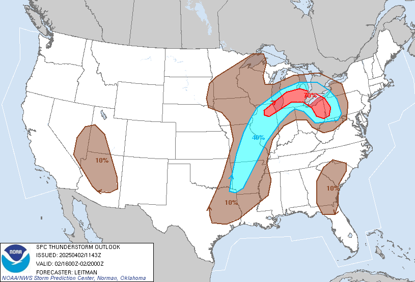 |
| Thunderstorm Outlook For Today |
Hydrology:
Rainfall Forecasts:


-->

For more!


