
Meteorological summer begins June 1st (along with the start of "hurricane season.") and the Summer Solstice is June 21st at 5:51AM. June 21st is the longest day of the year!
Remember, when the power's out, you can still hear our forecasts and live reports on Newstalk 94.7, 95.5, 570AM and 1320AM, along with The Mix 94.7 and Willie 102.1.


RADAR:
SATELLITE:
FORECASTS:
Paducah Union City
Carbondale Cape
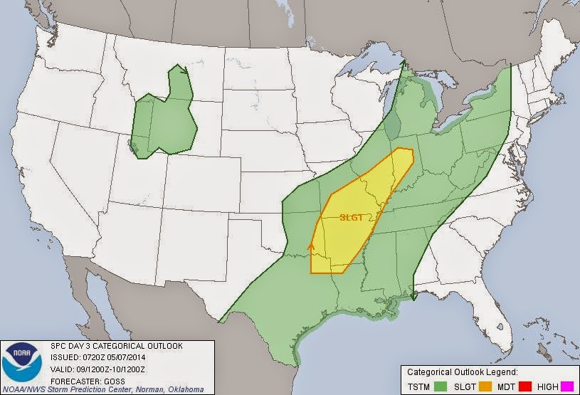
Storm Prediction Center
Model Charts Models
PSU Wall Graphical
MEM Graphical PAH Hazardous
SPC Meso 12-48 HR
Storm Prediction Center
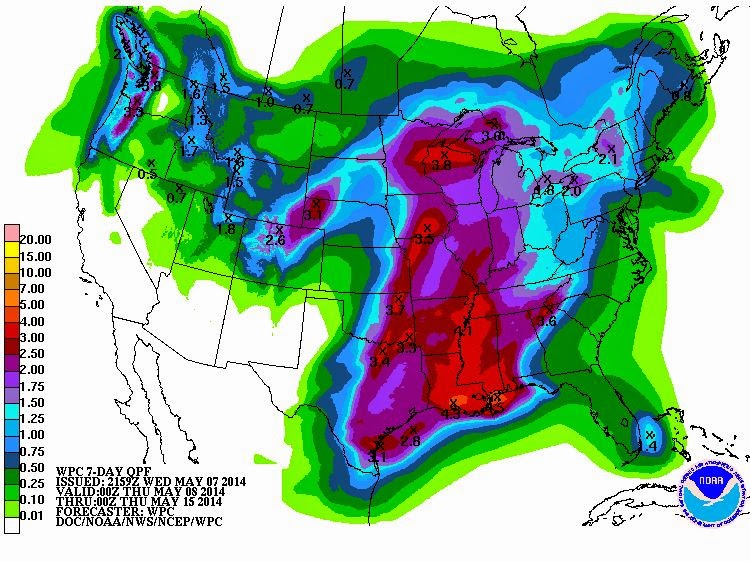
Weather Prediction Center
HRRR Radar WRF-NMM Radar
15 Day ECMWF
GFS NAM MURF
SREF EURO
COD Model Comparison
CIPS Historical Analog Guidance
Forecast Model Animations
PAH Forecast Discussion
Winter Weather:
Winter Wx Center
Wintercast
Tropics:
National Hurricane Center
Carbondale Cape
Storm Prediction Center
Model Charts Models
PSU Wall Graphical
MEM Graphical PAH Hazardous
SPC Meso 12-48 HR
Storm Prediction Center
Weather Prediction Center
HRRR Radar WRF-NMM Radar
15 Day ECMWF
GFS NAM MURF
SREF EURO
COD Model Comparison
CIPS Historical Analog Guidance
Forecast Model Animations
PAH Forecast Discussion
Winter Weather:
Winter Wx Center
Wintercast
Tropics:
National Hurricane Center
Hydrology:


