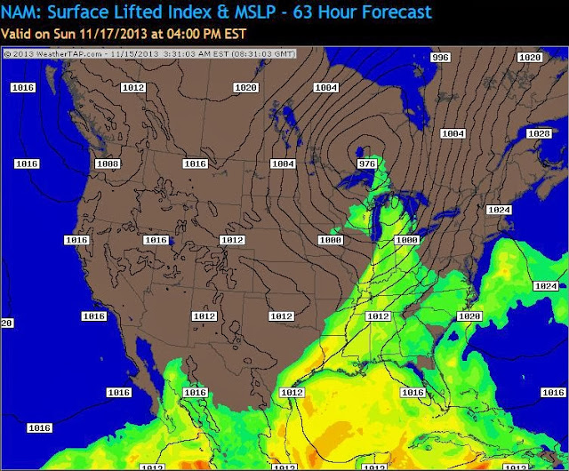
Right now it appears the biggest threat will be high winds and possible tornadoes. The threat of tornadoes comes with the possible development of supercell storms, then as the front prepares to pass through the area, the storms should form a squall line and move through. At that time the threat would be mostly damaging winds.
RADAR:
SATELLITE:
FORECASTS:
Paducah Union City
Carbondale Cape
Severe WX Outlook
Model Charts Models
PSU Wall Graphical
MEM Graphical
PAH Hazardous
SPC Meso 12-48 HR HRRR Radar
WRF-NMM Radar 15 Day Forecast
GFS NAM MURF
SREF EURO
Forecast Model Animations
PAH Forecast Discussion
Tropical Weather:
National Hurricane Center
Carbondale Cape
Severe WX Outlook
Model Charts Models
PSU Wall Graphical
MEM Graphical
PAH Hazardous
SPC Meso 12-48 HR HRRR Radar
WRF-NMM Radar 15 Day Forecast
GFS NAM MURF
SREF EURO
Forecast Model Animations
PAH Forecast Discussion
Tropical Weather:
National Hurricane Center
Hydrology:
Rainfall Forecasts:


No comments:
Post a Comment