
The latest data is in line with what we've been saying since Thursday: 3" (on average) snow/sleet, with the possibility of some freezing rain. The totals could go up or down locally. The main impact will be travel beginning tonight (Saturday night) through Monday midday. Stay abreast of the situation as it can change! Be Safe!

Your can hear my forecasts each weekday on Newstalk 94.7, 95.5, 570AM and 1320AM, along with The Mix 94.7 and Willie 102.1. Remember, when the power's out, you can still hear our forecasts and live reports on these stations, too.


Hydrology:
 |
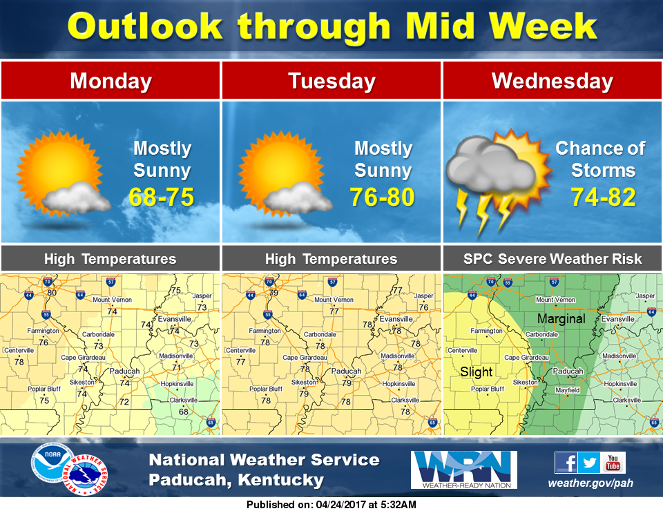
| There are 5 levels of risks: Marginal, Slight, Enhanced, Moderate and High Risk.Here's what they mean: |


RADAR:
SATELLITE:
FORECASTS:
Paducah Union City
Carbondale Cape
Storm Prediction Center
Ensemble Charts
Model Charts Models
PSU Wall Graphical
MEM Graphical PAH Hazardous
SPC Meso 12-48 HR
Storm Prediction Center
Weather Prediction Center
HRRR Radar WRF-NMM Radar
15 Day ECMWF
GFS NAM MURF
SREF EURO
COD Model Comparison
CIPS Historical Analog Guidance
Forecast Model Animations
PAH Forecast Discussion
Winter Weather:
Winter Wx Center
Snowfall Model Projections
Tropics:
National Hurricane Center
Spaghetti Models
Hydrology:
No comments:
Post a Comment