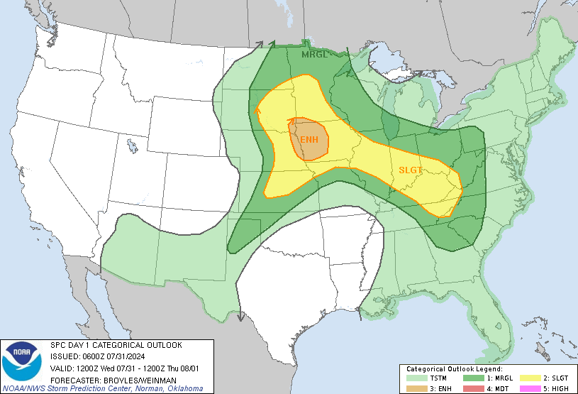
Our mains threats will be high winds and tornadoes! Make sure you have fresh batteries in your weather radio, cellphone charged and be ready to activate your emergency plan to take shelter should storms threaten.
These storms could also bring heavy rainfall, upwards of 2 and 3 inches! After today, we'll cool back down Friday and into the weekend.
RADAR:
SATELLITE:
FORECASTS:
Paducah Union City
Carbondale Cape
Severe WX Outlook
Model Charts Models
PSU Wall Graphical
MEM Graphical
PAH Hazardous
SPC Meso 12-48 HR HRRR Radar
WRF-NMM Radar 15 Day Forecast
GFS NAM MURF
SREF EURO
Forecast Model Animations
PAH Forecast Discussion
WINTER FORECASTS
HPC Winter Weather Forecasts
Wintercast Computer Snowfall Output
Snowstorm Tracks and Probabilities
HPC Day 1 Snow
HPC Day 2 Snow
HPC Day 3 Snow
Hydrology:
-->
Rainfall Forecasts:
-->
For more!


No comments:
Post a Comment