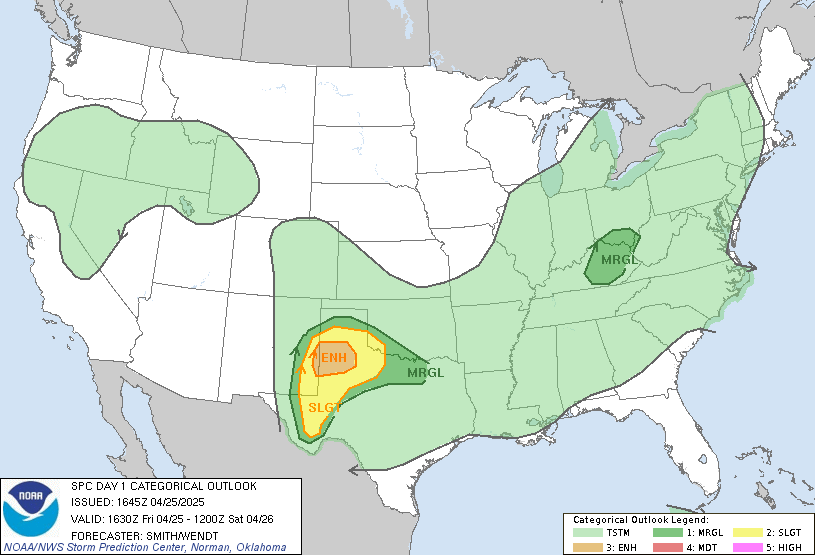
We'll continue to have the risk of severe storms this afternoon and especially tonight ahead of that approaching system which has brought tornadoes and severe storms to the Plains the past few days. The good news is that our chances for tornado development are less likely than to our southwest, so while an isolated tornado cannot be ruled out, right now it appears our greatest threats will be large hail and high winds. The greatest risk of tornadoes appears from Southern Arkansas to Northeast Texas, with part of NW Louisiana and SE Oklahoma as well. Keep an eye to the sky!
RADAR:
SATELLITE:
FORECASTS:
Paducah Union City
Carbondale Cape
Severe WX Outlook
Model Charts Models
PSU Wall Graphical
MEM Graphical
PAH Hazardous
SPC Meso 12-48 HR HRRR Radar
WRF-NMM Radar 15 Day Forecast
GFS NAM MURF
SREF EURO
Forecast Model Animations
PAH Forecast Discussion
Carbondale Cape
Severe WX Outlook
Model Charts Models
PSU Wall Graphical
MEM Graphical
PAH Hazardous
SPC Meso 12-48 HR HRRR Radar
WRF-NMM Radar 15 Day Forecast
GFS NAM MURF
SREF EURO
Forecast Model Animations
PAH Forecast Discussion
Hydrology:
-->
Rainfall Forecasts:
-->
For more!


No comments:
Post a Comment