
Down the line, a chance for wintry precip Sunday night through Tuesday as colder air moves in: freezing rain, sleet and snow. At this time, we're really not expecting anything in the area of accumulations, but the main threat would be of freezing rain and sleet making for dangerous travel conditions at times.


RADAR:
SATELLITE:
FORECASTS:
Paducah Union City
Carbondale Cape
Severe WX Outlook
Model Charts Models
PSU Wall Graphical
MEM Graphical
PAH Hazardous
SPC Meso 12-48 HR
3-7 Day HRRR Radar
WRF-NMM Radar 15 Day Forecast
GFS NAM MURF
SREF EURO
Forecast Model Animations
PAH Forecast Discussion
WINTER FORECASTS
HPC Winter Weather Forecasts
Wintercast Computer Snowfall Output
Snowstorm Tracks and Probabilities
HPC Day 1 Snow
HPC Day 2 Snow
HPC Day 3 Snow
-->
Severe WX Outlook:
 TODAY-TONIGHT
 TOMORROW
 Day 3
Day 3

Day 4-8
Storm Shield Tornado Shelters (Click Here)
-->Day 4-8
Storm Shield Tornado Shelters (Click Here)
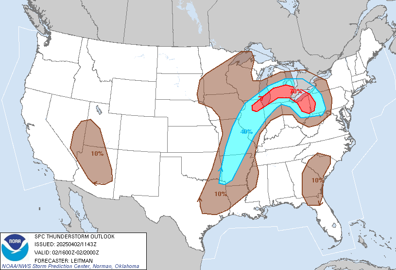 |
| Thunderstorm Outlook For Today |
Hydrology:
Rainfall Forecasts:


-->

For more!
No comments:
Post a Comment