
Here's the latest graphic and it depicts areas with at least a trace amount of freezing rain into Sunday evening. As you can see, it includes our area. The scale to the right indexes the percent probability of at least a trace of ice. So far, we're not calling for higher amounts, say a quarter of an inch or more, but we'll watch the models, especially into the weekend to monitor changes to the models! Stay Tuned!


RADAR:
SATELLITE:
FORECASTS:
Paducah Union City
Carbondale Cape
Severe WX Outlook
Model Charts Models
PSU Wall Graphical
MEM Graphical
PAH Hazardous
SPC Meso 12-48 HR
3-7 Day HRRR Radar
WRF-NMM Radar 15 Day Forecast
GFS NAM MURF
SREF EURO
Forecast Model Animations
PAH Forecast Discussion
WINTER FORECASTS
HPC Winter Weather Forecasts
Wintercast Computer Snowfall Output
Snowstorm Tracks and Probabilities
HPC Day 1 Snow
HPC Day 2 Snow
HPC Day 3 Snow
-->
Severe WX Outlook:
 TODAY-TONIGHT
 TOMORROW
 Day 3
Day 3

Day 4-8
Storm Shield Tornado Shelters (Click Here)
-->Day 4-8
Storm Shield Tornado Shelters (Click Here)
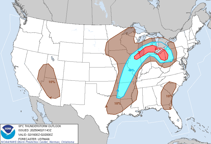 |
| Thunderstorm Outlook For Today |
Hydrology:
Rainfall Forecasts:


-->

For more!
No comments:
Post a Comment